I stumbled over the the database from the American air force listing their operations during WWII.
For someone who was as distracted as I was during history classes, just plotting these was a valuable piece of information.
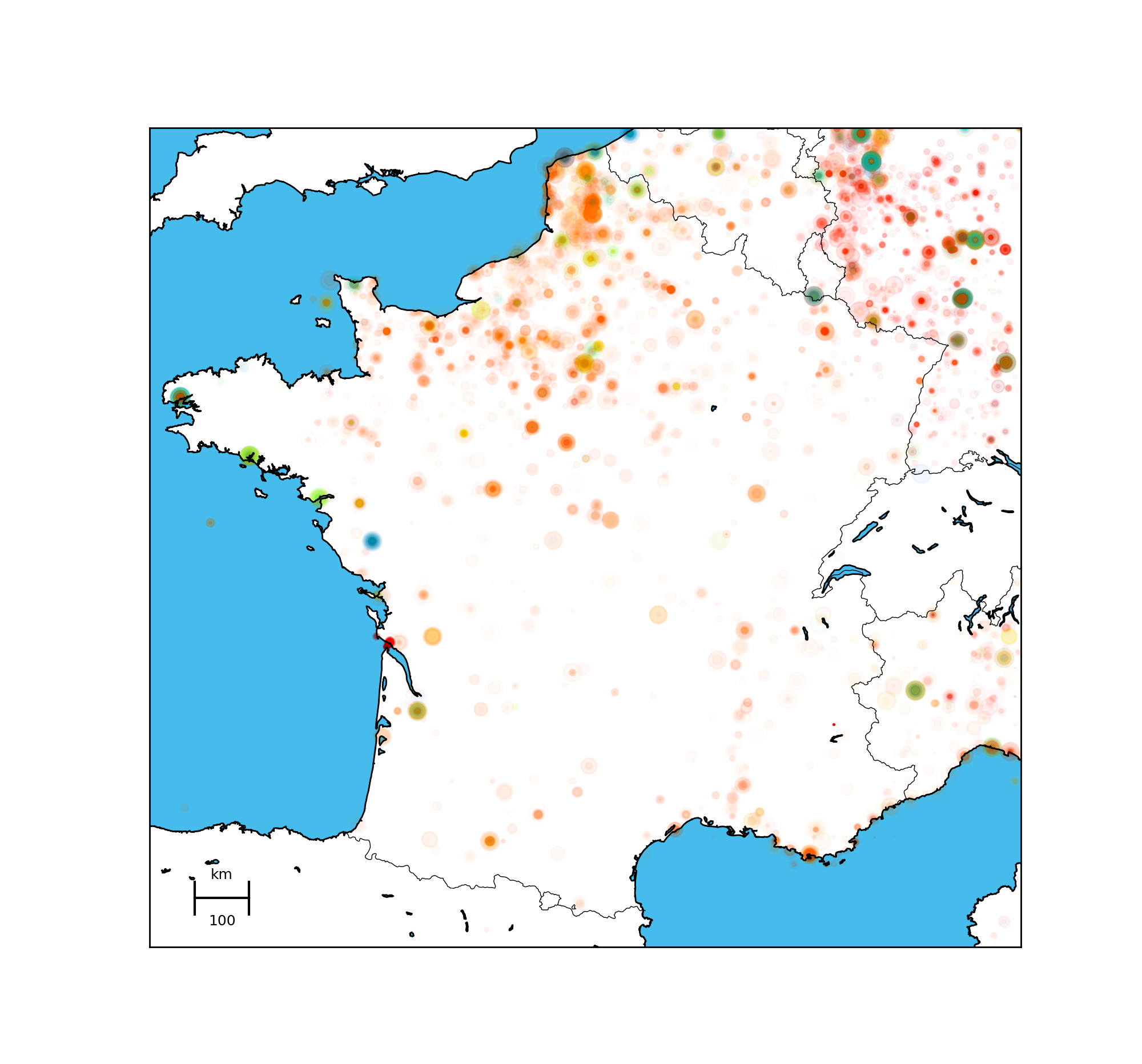
So most of the operations that took place in France were in the north, Nonetheless, I did not know there had beenso many operations in the south of France.
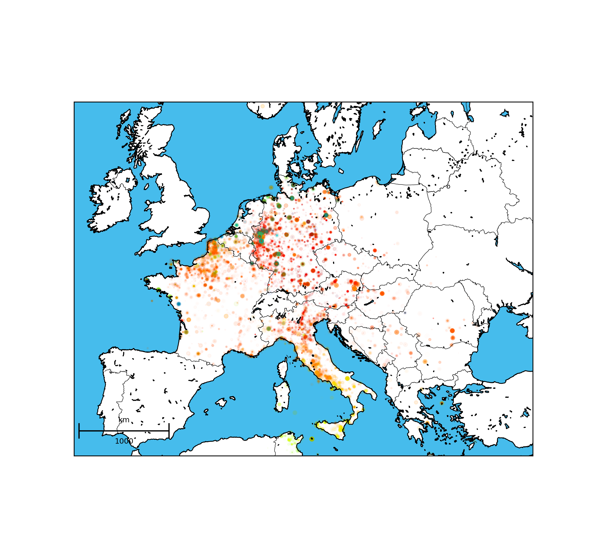
An interesting view was how bombing was rasterized. Color denotes the dates of the bombings with blue meaning 1939 and red 1945. You can clearly see operations beginning in Northern africa, moving towards Italy then France and finally Germany. An interesting feature I did not look into would be to correlate these bombings with land operations.
Another interesting thing is how no bombing from the US airforce took place in UK. This underlines how german bombers did not need any base to in Uk itself to launch their attack on London. And the contrast is pretty strong with the Calais region in France.
I was also suprised that there were a few bombings in Poland. Was there cooperations with Russians at the time?
Finally, one can clearly see how Switzerland was a neutral country.

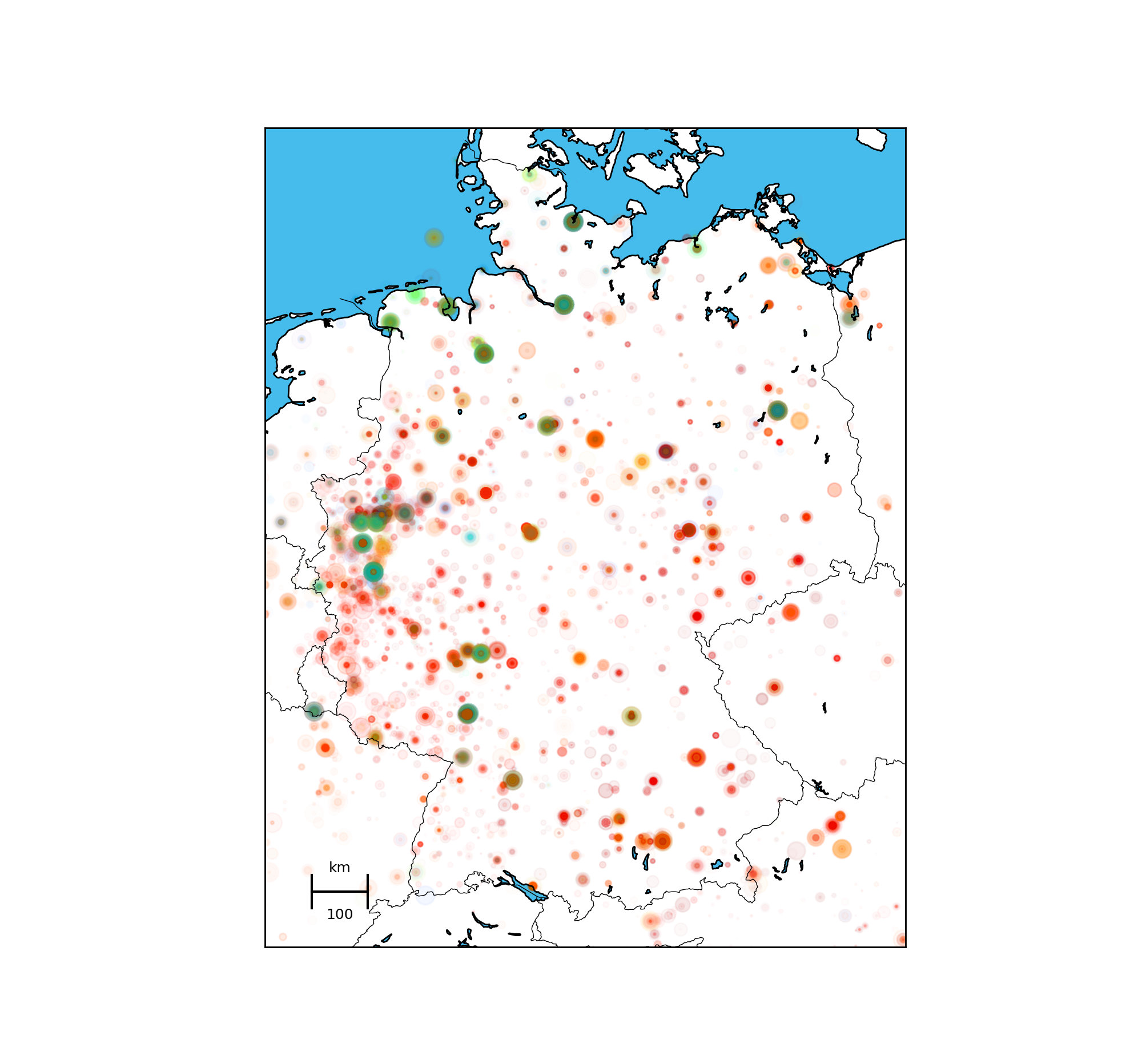
In germany you can see how the Koln area was plummered. I need to look into why.
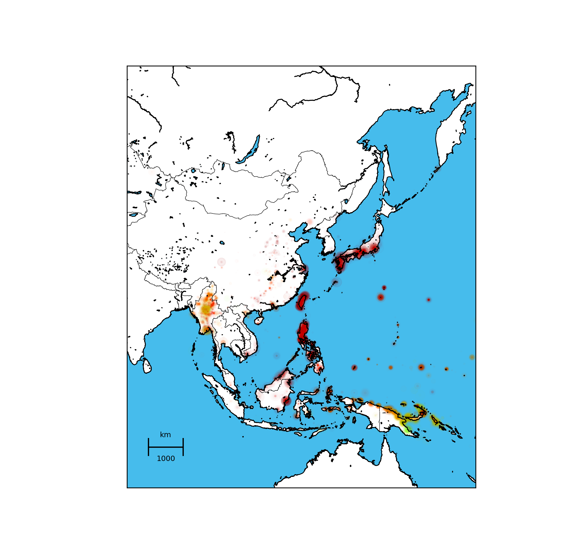
 Finally, as europeans (or people like myself who benefitted from european education) tend to forget that world wars happen world wide ! In this map, you can clearlys sea how US operations prevented Japanese to go towards India with Japan being heavily hit in 1945.

Again this probably is trivial to anyone who is knowledgeable about WWII, but the main goal here was to get accustomed to plotting maps and maybe have some fancy visual of how it was happening.